
UAS News Podcast — 2013-01-16
Transcript
Hello everyone and welcome to the 35th installment of the UAS News Podcast Series where we interview newsmakers and discuss the news and applications that are relevant to the global unmanned technologies community. I'm your program host as always Patrick Egan and I'd like to say our usual hello and welcome to the co-host of the program Mr. Gene Robinson. Hello Patrick we're ready to roll on this then.
All right excellent every time I say that I want to danger danger anyway I'm sure you've never heard that anyway never I know I know let's as we usually do talk about some of the news stories that may have caught your eye this week Gene what would you see? Well I'm pretty excited it's been posted up on SUAS News but I was invited to participate in the NextGen Institute's safety team and I was pretty excited to get that just before the holidays and sent them confirmation that I'd be willing to participate and help out anywhere we could.
I think it's going to be a pretty big deal for just about all of us if we're involved in the unmanned aircraft industry especially the small unmanned aircraft industry and I'm looking forward to giving those guys an input and seeing if we could make a difference. Excellent excellent well I do think that that's a good thing you know they there's a gaping hole in the let's say empirical knowledge side of this effort
and I think it's going to be great anybody who read the story to have your acumen on board and at the table there'll be a lot of times you'll be like now wait a minute you know because of that lack of knowledge and so I think that's great and I also want to reiterate that the SUAS News will is pledging support for some of the overhead of what it's going to cost for you to go there we put money where our mouth is here
and we put a percentage of our advertising dollars back into the advocacy effort so you people that advertise here at the SUAS News are aware of that and I'm going to ask the listeners and the viewers of the website to please support the advertisers at least go to their site check out what they're offering we have some good people out there and they are also giving back helping the community out and that's a good thing one other thing
I wanted to mention just came through this morning the podcast itself has become a featured podcast at blogtalk radio because of all the listens and views that we've had which is just it's off the hook I think it's kind of smoked everyone as far as what how many listens and views we've had and I to me it's confirmation that we are offering quality content to otherwise very busy people but they can come here
and get information obviously that they want to hear about your thoughts on that Gene yeah that's exactly right we just we're gathering up good stories we're getting good positive stories about UA use and not only the NAS but worldwide and we're trying to separate the wheat from the chaff and get the truth out there try to get some of the rumor and propaganda that seems to be running rampant through the entire industry
and get that out of the way so we can focus on what the real issues are and that I think has been a great benefit for us well I agree with all that I think the people you know are looking for this view I mean the email traffic and comments that I get from people about the podcast and the website are I got to tell you you know I'm going to throw out a thank you to all the listeners and viewers because
you know it's it's it's really it's humbling you know and people are like oh you know this show is great and I learned so much you know I'm like whoa okay great that's that's exactly what it's all about that's why we're doing this you know so I wanted to say thank you to everybody and you know upward and onward I hope we're I've got a lot of stuff in the hopper for this year and I hope we can we can just let's say meet everyone's expectations
and the other another housekeeping issue I wanted to give a shout out to our listeners in the Hindu Kush and I know it's just like vacationing at Sandals without the amenities or the pool but hey thank you guys for being out there Thank you guys for being out there.
All right so this week's episode episode number 35 is the USGS small UAS applications and we have two guests on the program today and I want to get to it because we got a lot of information and this is one of those shows where you know it's all about applications so I'm sure I'm going to enjoy this show and I hope everyone else does Let's start it off I want to start the program off by having today's guests introduce themselves to the audience
and I think we'll start with Mike Hutt and you can go ahead maybe tell us give us a little background how you got here what you do and what the USGS is doing Okay thanks Patrick for inviting us to join the podcast.
Gene we actually got the same invitation that you did right before Christmas so we hope to be able to meet you on the safety committee as it starts rolling after the first of the year. This is Mike Hutt I've been involved with remote sensing for about 30 years first with the Department of Defense then the Bureau of Land Management so past several years with USGS US geological survey the UAS project office is funded under the USGS land remote sensing program
and part of what we do is support DOI by evaluating monitoring promising remote sensing technologies things that we have looked at and implemented in the past include hyper spectral sensors lidar sensors synthetic aperture radar and we really like to see how those different evolving technologies can support Department of Interior applications.
So we've after watching UAS evolve for several years and really appreciating the effort that the Department of Defense put to developing UAS technology we determined that UAS had reached a point in the mature in its maturity that USGS decided that we needed to actually start implementing UAS technology across the department and we created a UAS project office in May of 2008. Since then we have worked with the department's office of aviation services to acquire systems conduct operator training certify airworthiness of systems conduct missions
and generally we are very excited and pleased with what we've been able to do with small UAS's so far.
Joining me is Jeff Sloan. Jeff Sloan is a remote sensing scientist for USGS he's also a certified operator of the systems that USGS and the department use which are small UAS's. Before we move on to Jeff's bio Mike could you tell us what your title is over there at the USGS?
I'm the USGS UAS project office manager. I like that you know we got enough Ackermans we got enough okay anyway. We're the government. I know it's good and it's early in the morning out here in beautiful California it's sunny it's nice it's a little cold but I'm working on my second cup of coffee.
Mr Sloan could you please give us a little bio about yourself and how you got here sir. Yes my name is Jeff Sloan. I've been working for the government for about 28 years. Started off with department of defense and jumped over to the USGS also did a stint with homeland security but my background is cartography photogrammetry and remote sensing so then when the UAS came available to us we became the part of the group that's trained to operate the small army surplus UAS.
Excellent excellent and that's all very interesting and again you know we're me and Gene and Gary are all about practical application of this technology. I know I'm only going to say one other thing and this is for the benefit of our listeners we have listeners from around the globe we get a lot of people all over the place so for the audience benefit could you please describe what the USGS is and does please Mike. The USGS US geological survey is Department of the Interior. The Department of the Interior is one of the older departments within the federal government is created in 1849.
Some of the things the department's involved with is that we actually have land management responsibilities for over 500 million acres of land or about a fifth of the United States landmass. Bureau reclamation manages nearly 500 dams 350 reservoirs they do deliver water to one in every five farmers in the western U.S. Supply water to over 30 million people. Department of the Interior has oversight of over 1.75 billion with the beat acres of that of outer continental shelf and it manages over 9,000 active oil and gas leases on 44 million acres in the outer continental shelf.
Fish and Wildlife Service, National Park Service, Bureau Land Management hosts over 460 million visitors on over 5,000 recreation sites across the U.S. Energy produced on federal managed lands supply nearly 30 over 30 percent of the nation's energy Department's law enforcement workforce is one of the largest in the federal government. Department of Interior also supports wildland firefighting and is part of the National Interagency Fire Center. What USGS does is we are the science organization within the department.
We provide impartial information on focus areas such as ecosystems, natural hazards, water resources, energy, climate and land use change. We also have a core data mission where the national mapping division is located. So we have a lot of things on our plate and in the military world we would be a target rich environment. Yes that's a lot of grass to mow.
Yeah and I've been into some of your grass too as a matter of fact Mike. I'd kind of like to think that I kind of may be helpful with the education process here a few years back because I don't know if you guys know it or not but I'm heavily involved in using UAS for search and rescue search and recovery and we've been out in the Mojave Desert and in Death Valley and as a matter of fact the DOI owns one of my aircraft that was going to be used for search
and rescue and if I'm not mistaken there was an agent out of your Menlo Park office that was using a modified spectra flying a TetraCam, a multi-spectral imager and I heard that it met an unfortunate demise up in the Sierra Nevada but you know I've been kind of involved with y'all's growth since this started and I kind of was in on the beginning of it and I was tickled to death to see you guys get more aircraft
so that you could get out and do some of this remote sensing that you're doing.
The National Park Service and BLM are very very interested in small UAS capabilities to aid their search and rescue. We actually have a project coming up in the Mojave later in the year where we're doing some wildlife surveys and also doing an infrastructure survey to get a better handle on the sort of materials that have been left behind in the National Monument over the past 30, 40, 50 years. So we'll be out there this year
and we would love to see you out there with us. I was just going to ask that question without trying to put you on the spot there Mike but I'd love to have Gene come out there and while you guys are doing that do a live broadcast if possible.
I don't know where you guys will be but if we'll have to take that offline and see if we could work that out because that would be a fantastic show and those are the types of shows that our listeners really like. Yeah part of what we try to do is be very transparent on our missions and if you go to our website there's a calendar there so if there's any missions that you would like to come out and witness and observe what we're doing just drop us a note and we'll schedule that with you. You know and I have to commend you on that Mike.
I wish that some of the other federal agencies were open and transparent. I think it's a big mistake. I don't want to get too far into the weeds here flashing back to the grass but I think that's a big mistake when these federal agencies take this technology and close it off to the public. You know it only makes people wonder why you can't be transparent so I commend you for that and Gene we're going to have to work that out about getting you out there.
I think that'll be excellent. Now I know you are. This guy he's ready to go at the drop of a hat so you know you might see him more than once. Now that was all pretty interesting Mike about what you do and I can see that there is absolutely no shortage of potential applications and I mean there's a lot of stuff going on with that but what I would like to do is you know maybe you could talk a little bit about some of the applications that you're doing now with some of this unmanned aircraft systems technology.
Okay I guess to begin with USGS has a long history in remote sensing. We've operated the Landsat series of satellites for several decades and we're actually looking forward to the launch of Landsat 8 in February of this year. So we were doing remote sensing with manned aircraft and satellites at least Jeff and I for you know both of us for over 30 years nearly 30 years. So what UAS provides us is a way to look longer closer
and more quickly at some of their most area your most remote areas of the earth which are the lands that really the Department of Interior manages and a lot of these lands are too expensive or too dangerous to monitor with manned aircraft or on the ground observations.
So using small UAS is it really enhances our ability to track long-term landscape changes and in addition we're looking forward to the day that we can really quickly assess landscape alternating events such as wildfires and volcanoes and really make UAS a part of our everyday capabilities and technologies. So in the department when we first started the program the wildlife biologists were the first group to really endorse and embrace UAS technology. Some of the things that they're looking at are monitoring in the inventory and wildlife.
We've had several missions where we're pounding waterfowl specifically sandhill cranes. We've had elk and moose surveys. A lot of wildlife monitoring inventory requirements coming out of the wildlife biologist. The next group that really was wanting to start using UAS were the geologists.
One of their interests is in are things like detecting monitoring landslides mapping fault zones. The volcanologists are interested in using UAS to monitor volcanic gases as one of the keys that they can use to help monitor the status of various volcanic events. The hydrologists are very interested in a couple of different things. They've had different shoreline erosion projects that we worked on.
They're interested in things like monitoring stream and water body temperatures using thermal surveys. In the past thermal surveys have been pretty expensive and so putting a thermal camera on a small UAS affords the makes it affordable for them to conduct thermal surveys that they haven't been able to do in the past. The fishery biologists are also interested in the temperature gradients and streams
and water bodies to help monitor different aspects of changes in the fishery habitat. The ecologists were probably the next group that came to us and really what they're wanting to do is use the UAS to help them monitor and map habitats.
Public safety is a big program within the department and they're very interested in using UAS to monitoring things like as Gene had mentioned search and rescue and also monitoring pipelines, wildland firefighting. In general what we're looking at is if the observation can be done with a manned aircraft today we really anticipate doing it with an unmanned system in the not too distant future. Well you know only a couple of uses you mention there so you guys really like me to look for some. We do a lot of different things so it makes it pretty exciting to work with evolving technology.
Oh yeah absolutely you know well I'm just sitting here and I want to let Gene in on this but I'm just sitting here going you're preaching to the choir. I mean this is the stuff that we've been talking about for like the last eight years, seven years. Hey this is all the stuff you can do and I have to tell you and I mean I would consider myself pretty well versed in the industry and the technology
and the applications and all the rest of that but you're blowing me away over here Gene. You know I've got to admit I'm a pilot first but since I started flying small unmanned aircraft I've gotten to appreciate the payload that's being flown.
Typically it's always been in my head I use my you know Mark 1 standard issue eyeballs to act as the payload and collect the data that I needed but I've discovered that the things that we put in our aircraft the cameras, the sniffers, the sensors, the multispectral imagers have just really become important and I kind of like Jeff if you could I know you're a remote sensor guy I'd kind of like to give you the opportunity to present what you see coming up, what you guys are using now and some of the exciting things that you're doing as far as payloads are concerned.
Yeah I can. A lot of the just the size of these cameras that are available as well as how we're able to maneuver these vehicles and then the low altitude that we're able to fly it adds a whole lot of capabilities that we were never able to do before. We're just scratching the surface right now we just have natural color cameras as well as a thermal detector but once we branch into multispectral or even into some of the radar
and laser type sensors it's unlimited what you can do with this. Nearly every day we're contacted by somebody who has a small payload that can fit on the UAS and they're getting smaller and more capable every day so we're looking at gas sniffing capabilities, we're looking at the wildlife biologists are probably most excited about the ability to pick up radio transmissions over an elk or a moose or a grizzly bear who has a radio color on the animal
and if we can triangulate that radio signal then they are spending a lot of time right now doing searches on the ground or with manned helicopters and aircraft and so if we can put that capability on a small UAS they're probably the most excited about the ability to triangulate a radio signal.
There are also people who are talking to us about putting radio repeaters up on small UASs to help radio communications for wildlife or for the wildland firefighters. Yeah you know it's interesting you say that with the RFID I'm assuming tags because I talked to people a few years ago that were talking about that for like livestock and also that they could monitor that with those RFID chips they could monitor the temperature of these animals and thus monitor the health of the animal. Is that kind of the same deal with the wildlife?
Are they doing that or is it just tracking? Primarily tracking but we do have a group of biologists up at another center up in Fort Collins and what they're wanting to do is monitor the temperature of different animals and relate that back to the wildlife health. One of the things that they're looking at is starting off some evaluations of livestock hogs, tattle and seeing if they can get to the fine point of the thermal signatures to see if they can detect healthy and unhealthy herds. Yeah there's a lot of potential there.
I'm not a trained veterinarian or anything but I could definitely see the potential for that. Interesting stuff. Well you know I mean we went over a lot of the benefits, obvious benefits of small unmanned aircraft systems or even unmanned aircraft systems and remote sensing and I want to you know some of them I want to just delve into it a little bit deeper because you know when I was doing it you know commercially
and I had my UAV photography business going the benefit that I saw for my customers or whatever you want to call them at that end was that I could get that information for them go out to the site get the information and have it in their email inbox within you know the morning and that speed of information one and then also I was getting directly what they wanted and they could direct me while I was
still out there hey this is the information that we need.
Are those some of the benefits you see using this technology besides the obvious cost savings advantage to the taxpayer? Are those some of the advantages you're seeing or maybe you can expand on some of the advantages that you're seeing with this remote sensing?
In many cases UAS technology is the only cost effective way to gather earth observations for the wide variety of applications that we've talked about earlier. You guys are aware of this but you know manned aircraft flights may not be feasible due to safety concerns. A lot of the DOI lands are in pretty remote areas so it becomes cost prohibitive to acquire remotely sensed data using manned aircraft. Hazardous weather conditions, smoke conditions, associated operations costs, satellites are
you know hindered by their once the satellite goes up it's pretty much in orbit and you may get image whenever the set resolution is and the revisit rates which are usually not when you want to actually image something.
So our goal on the cost side is really looking at 10 to 1 cost savings of using a small UAS or a traditional manned aircraft recognizing that what we're talking about is the remote sensing according to remotely sensed data. We still anticipate and don't forecast that manned aircraft are going to go away anytime soon and that we will continue to use manned aircraft for moving people and goods around.
So that's kind of the major benefits are that you know the cost is a major benefit, the safety is a major benefit and the ability to do things that we haven't been able to do previously because of safety and cost factors.
So we're now able to monitor on the ground things like phenology that maybe we collected data once every month. Now we can do that as often as the scientists feel it's necessary. And there's obviously some benefit to that correct Jeff?
Yeah just like Mike's saying we still need that up the data that comes from the satellites or the aerial platforms we're just adding another layer of information but the speed at which we can get that and the maneuverability and even the you know the video live video feeds down where we can get interaction with people like what you were saying for a quick turnaround it's certainly there with the UAS.
So Patrick, just wanted to explain that. Go ahead. I was just going to say one of the things that we've recognized is that the the processing side of things are lagging behind that we have all these new sensors and capabilities and we're looking at some low cost solutions to actually process the data but processing the data being collected by the UAS is the full motion video.
The other data is that the industry is still emerging. We're also recognizing that we're acquiring remote sensing processing capabilities for under three thousand dollars now that also use the cost is over a hundred thousand dollars to get similar capabilities. Sorry go ahead Gene. I was going to mention that one of the things that we run into and in terms that I think a lot of our listeners can understand is just take for example still photography don't even include video
but we go out and we'll do a lot of high resolution imagery on a search and and we can collect literally terabytes of data hundreds and hundreds of pictures and then you have to go through with a computer and you put them on a computer distribute them some of these images are rather large some of the the bandwidth may not be there that you need to get it out there so you're having to downsize them
and then you have to go through and do the change analysis or you have to actually view the picture or have someone train that can view the picture and look through it and that's kind of processes that we've been looking at for a long time and I know you guys are going to be having to take a real hard look at and you know can you do that on your laptop and can you process that image effectively on your laptop
and get it to the other scientists that require the information and that was what I was going to ask is is are you guys are you looking at things like wide area distribution and that sort of thing and solutions to your data issues are you going to mainframes or just what kind of approach have you guys taken toward that one of the things that we're able to do is since we're flying video images and we're using laptops in the field to download the images we actually in real time or near real time can retransmit those video images out to across the internet
and we're doing that today so that if you're interested in a specific topic whether it's a wildfire or a habitat survey or whatever it might be you can actually view that video in the Washington DC Denver Sacramento all the same time we actually have a chat window built into that so that if somebody in Washington DC wants the operators to hover over a specific area or to go revisit something we can do that with today's technology
and that's really really really low cost to us the processing side of things we on our website have a technology assessment link and what we're trying to do is work with other people for service department defense universities to see what different people are doing on the processing side of things and so we have some assessments of what we're looking on as far as the image processing side of things on our website it's again that's one of the things that also the sensors change every day
and the processing capabilities change pretty much every day sure well and i like the approach that you're taking it sounds like you're taking a pretty forward approach with the technology because all of that stuff is you know it's great that's what we should be doing and i wish we had more proliferation of this now i did want to ask this is one of the questions that i had and you kind of alluded to it earlier
and then jean's talking about something too but what types of unmanned aircraft systems are you using are you by using like store-bought surplus or homebrew stuff or a hybrid can you elucidate so we have made a decision that we're going to within the department of the charrier we are only interested in operating small uas's specifically systems under 20 pounds and a couple of reasons for that cost of the systems cost of maintenance we are anticipating that those will be the first systems actually allowed to operate routinely in the national airspace
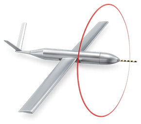
so what we are operating today we have the aerovironment raven and we have the honeywell t-hawk the raven is a 4.4 pound aircraft and the t-hawk is is approximately 20 pounds in general what we want to do is maintain a fleet of systems so that we minimize our operator training expenses maintenance expenses associated data processing requirements so we're trying to standardize what we're doing across the department
so what we're what we're also recognizing is that the small uas's aren't going to meet all of our needs so what we're looking at is hopefully in the not too distant future 2015 we will be able to contract with commercial companies to acquire access to data being collected by larger uas systems so that when we're doing things like statewide surveys of aero photography or lidar surveys we can reach out
and contract for those capabilities in the future so largely what we're doing is maintaining a fleet of systems and that we're doing conducting a lessons learned updating the u.s road map that we published a couple years ago and we're going to recommend one the next generation of small uas's that we're interested in acquiring maybe in 2014 sort of time frame all right and that that kind of uh that makes sense to me
i understand uh what you're saying with that one uh trying to you know standardize your training and your maintenance program and all the rest of that but you know that brings up a couple more questions in my mind and one of them is and you probably already covered this but just uh roughly how long have have you been at this went through the usgs um the project office was formed in 2008 and we actually got pretty lucky
and the army provided us with survey surplus ravens in 2009 and we started flying missions in 2009 2010 okay and then the other question i would because it sounds like you know i'm listening to you speak here uh mike and it uh sounds like you've you've put a little bit of thought into this and it's definitely not willy-nilly and i'm pretty impressed how you put this together so the next question is um has the faa come to
you guys for data or applications or some let's say empirical knowledge because it sounds like you're building it out there you're not horsing around so have they come to you and asked you for any data most of our interaction with the faa has been through the koa process so they haven't nobody's come from uh let's say the uapo you haven't heard from anybody down there saying hey you know it looks like
you guys are you got some koas over here uh you know like i said today we're doing this podcast i'm only talking to you here for a few minutes and i'm starting to realize that you got your thinking cap on you know what you're doing you know how you want to use it you're using it in remote areas all the rest of that you would think i mean to me i from what you're telling me you we hit the mother load as far as the data is concerned
and application data and i'm a little surprised to hear you know because i i know there's a big hole we've been hearing this for years that the faa well we don't have any data and these things are being operated so i'm a little taken actually we've actually uh been invited by the uapo to join one of their working groups that is also an invitation we received right before christmas uh we were a part of a working group on the xcom which is the nasa dod faa executive oversight group related to uas
so we have had some involvement with the faa and some of the executive level committees well that's that's it's interesting um you know and then i guess uh you know that was a question i was going to ask you uh you guys about the the koa process and i mean being being a federal group how how do you find the the koa process to operate and have you seen any improvement since the congressional mandate um we're we have a pretty good working relationship with the faa
and so one of the things that usgs we have it within the department of interior we have a office of aviation services so the office of aviation services was created as a focal point within the department so they managed the manned and unmanned aircraft so we work with project scientists and resource managers to put a koa in place it undergoes a usgs aircraft safety review and then it's sent to oas to review
and actually oas submits all of the doi koas across the department so they process park service blm office of surface mining and usgs koas and we actually um um have been working with the faa on the on the koa process and are able to call them and work with them and in many cases ask them what they think about the project before we actually go to the effort of submitting a koa the current koa package can be fairly labor intensive
and it require a lot of effort to to get a project approved right and i mean is that a you know if you're if you're going to do something where like you're going to do some mapping or whatever it's probably not a big deal but if it involves you know herds of animals that are migratory or you know fire or flood or some other event or even a you know a potential volcano eruption might be a little clunky
but you know we did hear that they've sped things up have you had any experience since things have been expedited um i don't know that we've really seen a lot of changes since the reauthorization language came out seems like it's pretty much the same process for us we're really looking forward to the day when the small uas rule comes out and we can operate small uas is in a more routine manner so we don't necessarily have to go through the koa process we tend to scare a lot of users away when we tell them it'll be 16 to 90 days before
you get from the project for them i know it scares me but i know it's it's hard to work through and then jean you know you probably have a little insight on that for the listeners jean's usual applications are they needed to be a little bit faster jean yeah that's true and we discussed that with uato but i don't know what y'all's turnaround is you know but a typical application has taken anywhere from six to eight months for a koa
i know i'm currently starting another activation of a koa that we have in place now and it has been a problem have y'all been running into those sorts of time frames have you been getting your colors turned around quicker than that or most of our applications where we're flying in pretty remote areas we're flying one of the advantages is that we only fly two aircraft so and we have the airworthiness
behind us we have the operator training approved by the faa we were down to about six weeks turnaround on standard was on the on the ones that were more difficult getting close to operating close to urban environment those take a little bit longer uh you know you just mentioned training you kind of touched on that and i was just wondering now are did you come up with your own training program or using the vendor training program
so what we did was a lot of our lessons learned came straight out of the military so initially we started off modifying the army's raven and t-hawk training programs and we've since modified we've since modified those programs and added additional information to those training so as a public agency the department of interior actually trains and certifies our uas operators and puts the operators through a two-week training class out of boise idaho
and we have three or four training sessions a year for both the raven and the t-hawk and so you're certified to operate those systems and we've probably put 30 or 40 people through those training programs and we've put both contractors and government employees through those excellent excellent well that's some definitely some good insight because i was kind of curious about that too uh you know and i'm sure there's uh your applications are a little bit different than dod um the other thing
i wanted to talk about is uh you know you had discussed a roadmap that you guys had come out with and i love to read these roadmaps i'm currently align myself with the air force estimation of a full nas integration in 2047 which is be there uh that's their 100 year anniversary but people are like well what do you really you know when do you think this is we're going to have full integration and like at this rate i'm with the air force um
but i would be i'd definitely be interested in seeing your roadmap the new one when it comes out we definitely love to see it over at sus news if it was possible for us to um to post that also i want to throw this out here too is if you ever have any press releases or you're doing some work and you think it's relevant to the community please share with us because uh that's that's kind of what we're all about here people want to know hey how am
i going to use this and positive uses like this are the ones that definitely need to be highlighted you have a public out there that's kind of scared of this technology but really they're they're not so apprehensive about this technology when you say hey you know i'm out here looking for moose you know i don't personally i don't i have never talked to anybody that has a problem with something like that or or public asset management or wildfires or anything else is really the the crux of the biscuit comes
right down to people don't want to be uh monitoring in their backyard like a moose but i want to definitely throw that invitation out there and i also would like to uh give you the opportunity to give us their website if you have a website address where where some of this work is is highlighted yeah the the road map is thanks for the uh invitation by the way the the roadmap is actually on the uh what our website uh website address is http colon slash slash uas dot usgs dot gov usually what
i just do is i google usgs uas and it pops up most people don't memorize web addresses so so if you just google it it uh pops up pretty quickly so that our road map is on the website we are just starting the process and process of revising that we would love to be able to reach out to you guys and get your input to our update hey we're here man that's what we're here for we're here to help uh educate
and disseminate information um ics is one huge global community i would i if you haven't been to the uh the symposium in europe that uvs international with rps uh 2013 i'd suggest you guys if you got the budget to go you're going to talk to civil aviation authority people from around the world in europe and they would be very interested to hear about the work that you guys are doing uh they're very receptive to that
and of course again if there's anything we can do please let us know gene anything you'd like to add we're down here on the one minute warning so go faster love to work with you guys i'd love to be able to to be involved in anything you guys are doing up here but uh absolutely would like to do the live podcast from one of your ops out there that would be a fantastic thing uh we we look forward to it all
right that's excellent we'll have to you'll have to look over that schedule gene because we will need to we don't want to uh unless we get you a satellite phone i don't know if you guys caught the podcast when i was out at white sands it was pretty rough but uh you know it's a mixed bag you get what you get when we're out in the field it depends on what the cons are out there uh you know and it's hard to see smoke signals uh over a podcast
so we'll see what happens i come in the future uh as far as today's guest go my god jeff slone i i really appreciate you guys coming on this was a great podcast extremely and um and i you know what well i'm sure we're going to want to have you guys come back in the future thanks for having us thank you hey no problem until next week gene see you everybody have a good week and we'll see you again take care we'll see
you guys