
UAS News Podcast — 2013-03-27
Transcript
Alright, hello and welcome to the next groundbreaking installment of the UAS News Podcast Series where we make history broadcasting applications of unmanned technologies live and from the field. This is episode 44. I'm your program host Patrick Egan and let's say as always hello and a warm welcome to our co-host Gene Robinson. Gene.
Hello Patrick, how are you sir? I'm doing good. I'm doing good. It's out here early out here in California.
Not that early but earlier than you guys have got. So you missed, you weren't on the drone law talk takeaway show but I don't know if you got a chance to listen to that but that was some pretty good informative information about what people are upset about as far as ethics and privacy. Did you get to listen to that or were you busy?
Sorry Patrick, we've been out in the field here and working for the past week or so and it's been tough for me to get any of the news unfortunately. That's what happens when you go out and you fly things around for a week. You miss out on a lot. Obviously you've been keeping up with it.
I know you spoke so you need to fill us in on the laws that are and the things that people are upset on. You know in a nutshell it's kind of pretty much like we had you know surmised. Most folks have concerns with you know the privacy issues and people spying on them but mainly it's the police. Again you know I still have I've been out there asking people you know what they think of a drone.
They describe the thing with the bulbous nose that kind of looks like the beluga whale with missiles on it. That's what most lay persons think of a drone and when the police are going to have drones that's what they think is coming here and they're not interested in that. I think that people see that as a civil rights violation you know the targeting killings and assassinations and all the rest. It's just a guilt by association.
Now when you talk about all of the positive uses for it people are all into it. There are no complaints and even the police you know hey you just get a warrant before you're going to do surveillance. I don't think we're too far off the mark. I really think that we could fix that problem.
It's a little bit more education but that was pretty much the upshot on that. So that was encouraging. That's more than we've been kind to espouse for the last several years and the privacy laws that are there and the procedures that the law enforcement need to use are still in effect and they should be enforced. Yeah and you know you're not going to get any argument from me and I will say that when they heard that they were like oh okay that sounds great.
I mean everyone left. Everyone left with a smile on their face, coat pink cut out early so it's not that difficult. I think what it is and I've said that one other time is you know if you're not thinking with a business plan, if you're thinking like you know an American and not without the business plan you can probably bring people into the fold and say hey you know here's what we want to do. Nobody had any problem with the civilian uses.
Nothing. Just the police using the same technology that's being used in Afghanistan on the Taliban here. So as soon as we get off the DOD thing, as soon as we eat, as soon as we realize that you know and you know the funny thing I was thinking about this not to get too far into the weeds but really there's only one offender, one offending company that we're paying the freight on and it's the beluga whale with the bulbous nose with the missiles on it.
But oh well anyway the other things in the news that I thought were pretty interesting and I just want to cover briefly, did you see the the Star Trek symbol in the sky over London at night?
I did happen to see that they had what was it up to 50 quadcopters with LED lights on them over the most secure part of central London? Yeah and okay so that's really I mean that was cool. I mean I'm a little bit of a Star Trek guy you know. I grew up on the original show and I was like wow that's really cool you know that they're using this.
Not only is it you know a big company basically put this on okay but I think it's kind of funny okay so you have that right and then you have been we ran that story and we ran another story on the SUS news about I guess AeroVironment and New Mexico State University are going to do a study where they're going to fly a UAS at night okay so for me when I hear that I'm like hmm okay so we're going to study flying one UAS or small UAS in the NASA over here in the United States meanwhile back at the ranch in England they're flying 50 of them in a swarm at night over London
and at one of the the top three busiest airports right around there in the world.
What do you think about that Gene? Well it's obvious that somebody's worked out the separation issues over there you know even if it even if they had to call for you know a flight restriction or something like that they obviously got it coordinated and I really don't think that they would call for any sort of diversion at London airport or Gatwick or any of those other hubs. I know is that kind of weird though
I mean it's like all of the it's almost a I don't I mean an Alice in Wonderland kind of thing I mean here you know we're leading the way right we're gonna it's it's it's March of 2013 we're gonna do a test at night in restricted airspace you got a swarm of 50 of them flying over London at night I mean is that even I mean does it to me the study sounds like a waste of money a waste of time there you go here it is
right here just ask these guys to write it down and there you are there's the procedure this is how you do it you got 50 of them flying in a swarm have a nice day that's me I don't know yeah oh you're not too far off the mark I mean and not only that to double the the insult if you will it was a commercial venture oh yeah well that's that's the uh the that's that's the the whole Alice in Wonderland thing to me is just paid for by a huge movie company who wants to invest in the technology who's going to use this more in the future
but not only that I mean 50 night time London I mean this this thing I mean they might have really been the uh air environment New Mexico state thing packet in you're just wasting time it's stupid I let one we're going to do one in restricted airspace it just doesn't make any sense to me I think what it does though is it helps illustrate how far behind the curve that we are here in the United States how far behind the curve on the technology how far behind the curve we are on the will to get anything done
and why is that I wrote a story about this it disappeared but I drew a direct um point a to point b line back to the DOD vendors we have been hijacked and co-opted by those DOD vendors and uh that's why we have the dysfunction that we have in this country so when you ask yourself hey you know how come I can't go out there and do business you know follow the follow the uh breadcrumbs right back to uh the DOD vendors because plain
and simple that's it I know it's going to make me popular um a lot of people are getting tired of me beating on the DOD vendors because for some reason it's not their fault it's my fault or somebody else's fault for asking questions and making the FAA angry um you know I don't know it seems kind of silly any feedback on that Gene well you know everybody since World War II the the the milspec process has been the standard that everybody seems to want to go to
but uh what you know and people complained about it later in the 60s and 70s because that's how we ended up with the $800 hammer and as you move into that that military industrial complex it just it costs significantly more money to play in that game and unfortunately for a small entrepreneur you either are resigned to being a subcontractor to one of the big guys or you end up having to spend a lot of money to get to the point where you're recognized as somebody who can provide a platform or service that'll work yeah
but more of that I mean I you know I'm going out on a limb myself and that's a rig game I mean that's that that whole process is is sewed up tight you know you it's even if you do have a good product if you don't uh have the right connections you're not getting in there and that's just the way it is I mean people don't even that's a whole nother show so let's uh let's draw it back on here uh today's show is pretty exciting uh we've been planning it for a while we've been talking about it for a while
and it is one of the uh news stories on the front page of the suas news and what it is is what you're doing this week gene so let's talk about that where are you and what are you doing okay we are at a national guard base in the middle of texas it's called camp swift and we are just outside of bass crop texas and we are doing some groundbreaking fire research with the national institute of standards
and technology mist we are out here because uh with the texas forestry service uh their assistance we have been able to set up a tfr a temporary flight restricted zone and bring our super bad aircraft out here and fly over areas that they were intending to burn anyway and it allows us to do a lot of science in a very short period of time and I personally happen to think it's probably the best bang for the taxpayers buck that that we can portray
right now because when you consider in the united states there generally is something on fire all year round and uh even now there's fires in colorado and we're approaching the fire season now where you know texas is burned florida's burned california burns and the the the dollars that and cents that get about cents but the dollars that get burned up and the the research that we're doing that could aid in in reducing that is just it's staggering
and one of the guys that we're working with and i'm very pleased to introduce here is working on this this groundbreaking exposure scale and i'll i'll introduce him now if that's okay yeah go for it yeah his name is alex medingitis and he works with the national institute of standards and technology and what i'll do is i'll let him introduce himself a little bit further and give a little bit of a bio
and we'll we'll let him tell you know his approach to this and what our goals are and then we can take it from there so i'm going to introduce alex right now alex excellent thank you for having me on your show i want to take a couple of minutes before going into the details of our current operation to provide a little bit of an overview the work as jim mentioned is done through the national institute of standards
and technology that is part of the u.s department of commerce and this work is done in partnership with the u.s forest service the main focus of our research are the structures that are being lost at the wildland urban interface and our primary goal is to identify hazard mitigation solutions to help us reduce losses in the future from such fires the work is done in partnership with the forest service because we're looking at hazard mitigation solutions both in the wildlands
and within the interface so we're looking at what can be done in wildland fuels as well as what can be done to harden structures and as well as how to lay out communities in the future in order to reduce hazard and ultimately risk well that would that go ahead i'm sorry no problem to give you a sense of scale how big the problem is it is growing very rapidly in the decade in the first decade between 2000
and 2010 we're losing about 23 to 2500 homes per year last year in the last year that we have data for 2011 we lost over 5000 homes the problem is escalating it is primarily right now centered in the southern and western parts of the country however it is growing and if you recall just recently a couple of weeks ago we had a fire in tennessee where over 70 structures were lost we've had a fire in myrtle we've had a fire in myrtle beach where over 100 structures were lost a few years back it is spreading
but primarily focused in western and southern u.s.
the three primary reasons why this you know we have the this problem escalating in scope it's high scale the additional fuel in the wildlands climate change and additional growth of the wildland urban interface meaning more structures are being built at the interface so with that background i want to tell you now a little bit about specifically what we're trying to do with uavs okay question so far oh no you're that's fascinating information it makes sense
and actually that was going to be the follow-up question is why unmanned systems or why you turned to unmanned systems all right what you thought of that all right let me tell you now specifically what we're trying to solve given the problem that i have outlined and then show you where the unmanned systems are fit in and why the challenge that we've had one of the primary challenges with this problem has been essentially the lack of quantifiable information specifically with respect to fire
and ember exposure so let me let me give you a little bit of additional perspective and that will really help hone in on the work we're doing here the island and wildland but interface fires are one of the last natural disasters if you will that don't have a scale associated with them so you can think of earthquakes you can think of tornadoes you can think of hurricanes we have intensity scales associated with those events we we have not had historically a scale associated with wildland urban interface fires
and as a result every fire appears to be the worst fire so this lack of scale has prevented us from quantifying the severity of the exposure and when i talk about exposure i talk about fire as well as embers embers being those flying glowing fire brands or debris that's due to the spread of fire so this past december uh mitch together with the u.s forest service uh or me uh we created this um we covered scale specifically to address this issue
and this is absolutely critical because it enables us to link the field conditions through a well quantified path can follow the dots from the field conditions to test standards to sorry to test methods and ultimately to coaching standards that are then adopted to build safer communities so this is kind of like um what you're getting at here is this so if we had an earthquake we have the richter scale
and then people hear oh it's a 8.2 earthquake or or a tropical storm that is exactly it so okay uh another way to think of the wooy problem uh is and that's that's what we have um use of one one analogy hey look if you want to build it just take as an example uh if you're in a building california uh you use certain seismic criteria that are linked to building practices best practices to code and standard testing
right and that's how your buildings can withstand certain earthquake exposures right or oh sorry go ahead yeah our scale is aimed it's the framework that's going to enable us to link the field conditions to the test standards which will then once introduce the building codes and standards and best practices will enable us to reduce uh structural losses uh and of course human losses at the wildland urban interface
right and then go ahead well i'm just going to say so that would also probably come into play like we were talking about the building codes for seismic i mean i have a cabin out in the woods and then i get assessed a certain amount of money for fire fire prevention and then also the difficulties of trying to get uh structural insurance because of forest fires and everything else and everybody kind of gets hit with a blanket because there's no standard that says this is whatever zone here yada yada yada is
and and so that will probably come into play in the future here is this develops is that correct absolutely and this method this we while an urban interface has an exposure scale can be used not only to help with land use and the design and construction of new communities but it can also be used to assess evaluate and retrofit in a cost-effective way existing communities so is there interest from the insurance community have have they been involved with
you guys are you just doing your own thing so we are not doing our own thing this is a in a partnership uh with several states of code organizations and the insurance industry so uh the challenge here is um not one of it's not an institutional challenge uh the the industry scientific community codes and standards communities everybody's supportive of the technical foundation the challenge here the overlaying the overarching challenge is a technical one we have very little information
and that's where now we can dive in and talk about unmanned aerial vehicles that's one of the pieces of the puzzle that that that we're trying to solve here specifically in this exposure scale so let's talk specifics what we're trying to do is we're trying to create a scale both for fire and inverse and if you think of the exposure the three components that drive exposure fuel topography and local
weather when we talk fuel we don't just talk wildland fuel we talk all fuels they can be urban interface fuels they can be structures that burn they can be cars that burn sheds gazebo's fences or ornamental vegetation or wildland vegetation so all of fuels we need to understand two things what embers and fire they generate when they burn and what it takes to ignite them so let's focus on what embers
and fire they generate and let's furthermore zoom in and look at wildland fuels what we want to do is we want to be able to quantify the fire number exposure from different wildland fuels and this is what we started doing here in texas with our unmanned aerial platforms so specifically the we're starting with the simplest um technical configuration uh because even that is quite complex so we're going to start with homogeneous fuels such as grasses
and we're going to look at flat terrain with low to moderate winds we want to collect fire behavior information now the way we want to do that is by using an unmanned aerial platform which can loiter for a significant amount of time and enable us to capture the critical fire burning zone now we're not only interested in the leading edge we're only interested in the trailing edge and that is absolutely
critical it's critical for us because in order for us to solve the big picture technical problem we need to create reliable tools i.e.
computer models and we cannot conduct safe experiments in the very severe conditions under which some of those wildland urban interface fires occur for instance we cannot safely conduct experiments during santa ana winds in high loads in steep terrain it's just not safe so we are using our models to understand the technically simpler cases validate the models and then use those models and apply them to the more complex conditions that cannot be safely tested out in the field does this make sense it makes perfect sense
so you know how did you let's say land on the unmanned aircraft tool let's say for this that's a great question let me give you the the the history where we are in terms of our wildland field data collection as you can count on on less than one hand the number of studies that have generated today to date reliable data for wildland model validation there is very very little information out there the australians have really pioneered some of this work by conducting over a hundred grassland experiments
and they used a fixed wing manned platforms to collect their data we have some of their data and we've been using it for a model validation however we have identified a number of limitations with the use of that particular technology looking at the specifics of where we want the data to be collected the the specifics of the environment smoke altitude duration of the flight payload sampling rates and
and the additional weather data that we're collecting a lot all of this led us to the use of unmanned aerial fixed wing platform now let me ask you one other question this is kind of a let's say you mean like a fire weather type of question i mean i would imagine you know we've heard from some other people that are using these unmanned technologies and they talk about the different variables and then
so i'm going to ask you kind of a technical question about the variables in your data collection so if we have a fire there are undoubtedly variables as far as say moisture content the air temperature wind speed wind direction and then also i guess uh variables as far as the rainfall for the year vegetation things like that do those factor into your models and and how do you quantify those there's a great question the short answer is yes for the vast majority of the variables that
you specified we have developed a model called wfs uh violent urban interface fire dynamic simulator and that model is based on the missed developed fds model fds stands for fire dynamic simulator this is a fully coupled three-dimensional uh fluid model that handles combustion so it has chemistry in it it has materials in it it tracks momentum heat transfer all the navier stokes equations it's a very very robust technical model that enables us to capture not only the combustion process
but also the fire atmosphere interactions so specifically what we do during those uh instrumented prescribed burns we collect by a sample wildland fuels and that's done through the forest service because they have all the expertise in that part of the um in that area they uh they collect the wildland fuel samples and we essentially take the fuels apart you can really think of it as deconstruction of the wildland vegetation we literally take it apart down to the twig level
and measure the attributes of the fuel weigh them sample them look at the moisture content and this information is then provided to our model but that's not all when possible we also use additional aerial in aerial data such as lidar to help us map the wildland fuels and create a three-dimensional representation of the wildland plot or parcel that we're going to be burning in our model so is that the primary function for the unmanned vehicle uh is the lidar or are
you collecting other data with them too so we uh right now the lidar information that we are collecting is based on um manned large fixed wing platforms because of the weight of the lidar sensors the unmanned aerial vehicles that we have uh have three um specific purposes number one is to map out fire behavior during prescribed burns and this is what we're here doing in uh texas really for the first
time um quantifying some of the particulars of our flight ops um for the ground conditions of interest to us the uh second objective in terms of the implementation of this technology to our specific field uh down the uh line we are interested in using these aerial platforms and manned aerial platforms as part of our post-fire data collection process we have an entire um project aimed at post-fire data collection we have developed this methodology the methodology actually was used here in bastrop during the 2011 bastrop fires that were lost over 1600 homes um we used this method in amarillo texas earlier in 2011
and this is a result of our early data collection efforts in california during the witch and gaheeda fires in texas and we have during the witch and gaheeda fires in 2007 so we go in and instrument and map the aftermath of the fire in the community in order to reconstruct in very fine detail what happened in time and space as the fire moved to that community and we want to be able to now use unmanned aerial vehicles in a post-fire setting to get some very high resolution imagery
right after the fire has moved to the community before anything is disturbed um but the third part is there is uh potential here for UAVs to be implemented as part of situational awareness for the instant commander during some of those large events but in terms of the evolution and progression our first mission or our first objective here is to collect data from prescribed uh birds and that is a very long term um undertaking because there are many fuels many topographical conditioners
and many weather conditions that we need to map out but as we move further along the next objective is going to be to go to incidents and apply post-fire and help and use UAVs to help us with our post-fire data collection but because of the mobility of the platform and the longer later time and all of those attributes all right so uh so primarily the the first let's say prong here is going to be more of a uh forensic type of of study where you're going to be checking out how different fuels burned
and paths and things like that um and so let me you know again um how many uh how many of these aircraft does NIST own we have five aircraft they're not all configured in exactly the same uh way for uh different reasons so we have uh uh aircraft that have um uh infrared cameras on them and then we have uh aircraft that have higher resolution uh visible and depending on what type of data we want to collect
i want to point out um just uh when we when i mentioned we're doing this or you know we will be doing this for prescribed burns these vehicles will be flown during the prescribed burn uh so it's not forensic in the sense that we're doing it after the fact like we're going to be mapping out communities we are actually interested in collecting the fire spread information as that fire is moving through our fields of our of our wildlife fuel that sounds good
i like that so you're getting some uh some real-time data as the fire is burning yeah and this is uh really uh the uh technical challenge is to pull not just the UAV data by itself i mean there are a lot of technical um challenges associated with getting good quality UAV information but that's not sufficient for us uh we do this together with an extensive array of ground-based sensors to help us collect information on heat fluxes to help us collect uh wind information near ground
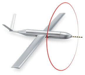
and we also use ground-based sodas that's uh sound detection and ranging instruments to help us look at the window loft up to 200 meters uh agl so it's a complete package of pre-fire fuel mapping and fuel sampling along with weather data collection during the event together with the UAV information and uh are you guys using all of the same um unmanned aircraft systems the superbat yeah all five of our platforms are super bad we are only flying one platform uh at the time
you know that makes sense it seems like uh that's kind of the running uh running mindset is to uh buy all of the same platform and i guess it's easier to keep things maintained and flown and and know the platform um okay so you know that's all uh extremely interesting and i'm really liking the science part of this and i understand what you're saying and it all makes sense and i can definitely see the uh benefit to society
and the country and everything else and people and property with the um collection of this data and the use of this technology now let me i want to ask about the mechanics here you know what's the uh exercise setup was there a set plan you said you're you're you're in early uh with this technology so is there is there a set plan or you guys kind of uh learning as you go along and kind of evolving or what's that look like
well let me give you a little bit of background um i uh started uh planning this of field data collection with unmanned aerial vehicles when i was uh in uh australia because we got called with um my uh technical partner ready mel from the forest service in australia after the 2009 um black saturday fires to help their post fire data collection methodology so this process started in february 2009 uh
so this has not been just uh put together in the last week it has been uh planned laid out uh we started the uh co-op process we got our co-op in place uh yet technical team um of the flight operators the observers all of us you know all the training the um science has been uh evolving maturing but all with our exposure scale in mind uh the data that we're trying to collect is really does not exist anywhere else
and it's absolutely critical to help us solve uh to help us address this wildland urban interface problem if we cannot map out fire behavior in the wildlands uh in a quantifiable way i'm not talking qualified quantifiable we need to be able to track fire behavior we need to understand what is burning when where it's burning why it's burning if we can do all of that then we can develop reliable implementable
and tested hazard mitigation solutions so the uavs are a small part but a critical part of our overall technical plan to to reduce losses of the interface hmm interesting okay so you're directly applying the tool to the knee fair to say absolutely absolutely you know we have identified uh you know almost five years actually a little over five years ago but uh this would be a very um uh that the potential was here for um for this technology to help solve this specific um technical need
and uh now we are right at the edge where we can start demonstrating um the benefits of uh of this technical coupling between uavs and field fire research and and patrick i will want to interject here that one of the things that we've been doing from a procedural standpoint is we've been building our own process to prove we can conduct these operations safely we've got uh we're tabulating the number of flights that we have in
now but we have countless hours launches and landings and we've we've got a very good record and i think that's a part and parcel we are developing the the safe procedures that we use and you know we're conservative about our our flight parameters but you know we've always managed to get get the job done uh additionally you know one of the things that we're learning is that the standard suite of sensors that we get even the clear imager that we we've gotten uh we discovered that uh clear imagers are are set up to detect body temperature
so after 160 degrees they're no good to us because they sat completely blank out so we've had to do some payload development and payload research and we're testing all that stuff and and uh yesterday we we had a very large fire that we got to fly over for an extended period we were in the air for almost four hours yesterday and we got to test the the flare modifications that we made and it was very impressive to watch the fire front
and see multiple bands of color as the as the fire moved through burned it was very hot in areas and and then you can see the gradual reduction in heat so you know it's all a matter of the learning process and and alex has been very good very patient with us as we go through our our flight development process as well and it's it's worked out pretty good we've we've uh we've modified the bats and we've flown them in just about all kinds of conditions that we we are comfortable with
and it's working out pretty well and we like that we like the platform yeah i would like uh just a couple of things the the research here is uh technically very um challenging but i want to emphasize the safety component uh everything that we do has been tied to training that we have been provided by the manufacturer all modifications to the plane are done by the manufacturer and everything is done explicitly following every single requirement that has been provided to us through our co-op
so the operation is uh very precise and uh we follow all the protocols that have been developed very um strictly and none of that has prevented us from pushing our science forward it has uh it has worked very well and uh we were able to um uh really over the last year uh develop the uh technical know-how to uh that's going to push this exposure scale forward well that's it's it's uh very interesting
and intriguing information and concept well we're down to about uh 35 seconds here it happens quick i don't know if jean warned you alex we got it's always every time i start wow jeez in 45 minutes here but uh it happens rather fast very fascinating we're going to have to uh i'm going to definitely say let's uh let's have you back next year because uh it i'd like to say okay well we have a year what did
you collect what are your interpretations what's the cost versus value yada yada yada so we'll have to check back on that um next year but alex i want to thank you very much for coming on very informative uh i really find the uh the science side of things um fascinating and jean thank you for the insight you guys have a good uh good rest of the week and we'll see everyone next week okay we'll see
you patrick thank you bye bye