
UAS News Podcast — 2013-03-06
Transcript
Alright, hello everyone and welcome to the next installment of the UAS News Podcast series where we discuss the news and issues that are relevant to the global unmanned technologies community. I'm your program host Patrick Egan and as always let's say a big hello to our co-host Gene Robinson. Hello out there, it's been quite a busy week, we've got a lot to talk about. We do have a lot to talk about.
I did see that Reuters did a nice two-parter and Gene you didn't hold back with your comments. I think you've been hanging out with me too long Mr. Robinson. No, come on.
Just the facts. That's all you have to do. You just state it straight up what has happened and what's going on. I mean there's no really anything behind it other than just what happened and it was factual.
I think the guy, I think Chris did a good job on it. I don't know him but I think from an immediate standpoint I think the guy did a good job. It was a two-parter and it was very nice to kind of explain about how the Chinese are ramping up and things that are going on here stateside that are slowing down. It is what it is, isn't it?
Well, it is what it is but it's kind of funny how there's all of this other stuff going on and people don't really realize what's happening. Still talking to people, still trying to talk to another kid yesterday, South Dakota, wants to do this as a business. He can't figure it out, he's trying to suss out the rules and all the rest of this. I see all these people doing it and I'm like, I wish I had the magic sentence.
It's all by comfort level. Some people are comfortable operating outside of federal regulations. Some people are in denial. The real, for me, the heartbreaker is the guy wants to follow the law.
He's at a severe disadvantage because the guy that's not following the law is out there making money and building a client base. When the regs do go, here he is, he's waiting to get in on the game. Anyway, another one I wanted to talk about. There's a lot of stuff going on but I called AIAA about their policy symposium they're having here in California.
It's the Civilian Applications of UAV's California perspective. I called to inquire how it was civilian. One of the speakers is director for operations for the Center for Asymmetrical Warfare. Does that sound civilian to you, Gene?
Warfare? No. For civilian operations, how does that fit?
Go ahead, just tell us a little bit about it. That was my question. I don't understand the asymmetrical warfare thing. Anyway, it goes on and on.
After that, I had to ask, is AIAA a pro-aviation group? Things started to get a little contentious after that. To me, warfare and commercial are not working together. I said, you have some other vendors on there, DOD vendors.
He disagreed with me. He said basically Arrow Environment was the only manufacturer company that had any experience with search and rescue. I was like, really?
I hadn't heard of them doing any search and rescue. He said, well, in Iraq and Afghanistan. I was like, that's more of a combat thing in my mind. Gene?
I would have to agree if you're in the sandbox or the rock pile that theater of operations is generally considered military by all aspects. I don't see how some of those tactics can apply. I've only been doing search and rescue now for a little bit. I don't know that I'd use any of those tactics.
That's just me. We've developed it over the course of about eight years. Military tactics don't have a lot to do with what we do. Then I kind of made that point.
He hung up on me. Okay. Whatever. I don't know.
I'm just a plucky kid out here trying to make his way in the world. Yesterday we had the near-miss of the Air Italia and the drone out there, JFK, which is causing quite a stir. I actually got interviewed for NBC Nightly News, but I got cut, which is probably an okay thing because there was no makeup person. I probably looked like Frankenstein.
But whatever. Upward and onward. How about you, Gene?
Anything to catch your eye you'd like to talk about? Back to that incident, Patrick. It was surprising to me. We had first seen that the pilot had reported it, but then also a passenger actually had seen it and reported it to the flight crew.
That gives you an idea of the perception and the public awareness of what's going on with unmanned aircraft. There are a lot of people that are sitting in 6C over there having to look out the window and recognize what they saw. That's kind of a good and bad thing, of course, that they see it and recognize what it is. The really bad thing was that it was at 1,800 feet and it was in the approach path of JFK, which to me, guys, we've been saying this for a long time.
If you're FPV or you're flying for recreational purposes, regardless of what you're doing commercially, you've got to be aware of what's going on out there in the airspace. You've got to think about where you're at. 1,800 feet, goodness gracious. You're well out over the outer marker on the ILS flight flow coming in from JFK. We've been trying to stress this for a long time.
The RCAPA folks have been trying to stress that you need to learn the airspace and you just can't grab a quadcopter and go up and be king. Right. Well, that was the point I made. I don't know if that made good copy.
It seems a lot of the news is really like fear-based and sensationalized commentary. My interview was like people need to get educated. You don't fly in the approach of any airport. I talked about AC9157 as a good guideline and the 400 feet, 1,500 feet laterally, three miles minimum from an airport.
Get educated. Anybody could go out on the Internet. I've been saying this for years. All of this has been coming and some people are like, oh, that Egan guy, he's a visionary or a futurist.
I don't know if I'm that. I'm on the Internet. I look around. People can buy these systems now for a couple hundred bucks.
You can buy a pretty robust system for about $500. People ask, well, even the reporter was like, well, isn't there some sort of electronic or software governor you could put on this thing to limit the altitude?
I said, yeah, there is. That's feasible. You could do all kinds of stuff. I said, this group is pretty technically savvy.
They'd probably hack that or have a workaround in about 60 seconds for that. It's more of common sense regulation, which I emphasized. Most people want to operate within the law. Maybe that could be debatable because there's thousands of people flying every day.
I brought that up, too. It's all the times been going on. People think that this is all new and it's just starting to happen now, which is not the case. It's just that there's more people doing it, I guess.
A lot more people that are not educated are just buying these things and flying them around. You really should get educated. If one of these things did, I think they were pushing me to say, oh, it would have been a disaster. I can't say how big the thing was.
It would be conjecture for me to say it was a disaster. I would just say that anybody flying in that area or another story we ran where people were flying and filming planes at Logan, I think in Boston, that is just crazy, man. That is just crazy stupid. Let's be responsible.
Don't wreck it for everyone else. There's always a couple of bad apples. The upshot was go on the FAA's website, get educated, learn about the airspace, let's use some common sense and let's not have any tragedies. That's what I had to say.
But that got cut out. I guess that was too not fun enough. I don't know. Maybe it was the makeup.
But anywho, anyway, so anything else? Get your attention, Gene. No, that's the main thing. I was quite concerned about that and the perception.
But I tell you, I'm really excited about our guests that are coming on. I haven't grown up on the Gulf Coast and in the impact zone for hurricanes and things like that. We always look to get our hurricane information. There were always guys out there in Noah.
Well, and before we bring our guest on, I wanted to, you know, how did the deal go with the Alamo? Oh, actually not much of a segue into UA's there. Hi there, well. We did deliver the cannon from its goat barn house to the Alamo.
It was very well received. I'd like to say that we are now starting a project. We're going to try to build a real 18-pound cannon that we will give to the daughters of the republic so that we'll have a lasting legacy that will show up and last a little bit longer than a Hollywood movie prop. It was very well received.
It was a good weekend and we had a great time with it. Well, I wish I was there. I love history and I'm sure that was a lot of fun. All right, well, we got off into the weeds, as it were.
We're going to be starting on this episode 41's guest and that is Mr. Alan Leonardi, Deputy Director of NOAA Atlantic Oceanographic and Meteorological Laboratory. Hello, Alan. Hello.
How are you doing today? I'm great, yourself?
I'm doing good. You know, there was a little bit of weather out there on the East Coast, but I guess you got in. I don't know what exactly happened out there, but in any event, as always, we bring guests like yourself on the program here. Maybe you could give us a little background about yourself, what you do, and how you do it, and how you became involved with Unmanned Systems.
Sure, thank you, Patrick. I appreciate it being on the show also. As you noted, I'm the Deputy Director of NOAA's Atlantic Oceanographic and Meteorological Laboratory here in Miami, so we, fortunately, are avoiding any winter storms this time of year. My classical science background is in both meteorology and oceanography, and my focus had always been on atmosphere-ocean interactions, primarily through the use of complex numerical models of both the ocean and the atmosphere.
But anybody who works in the modeling field long enough realizes that the models are really only as good as the data that you collect to either drive them or validate them. The challenge, of course, with that is that collecting some of the most important data can be either too expensive or too dangerous to collect in any practical manner. That's really where Unmanned Systems come into play, and where
my entree into Unmanned Systems in the last few years has jumped in is to give us an opportunity to gather data that we might not be able to gather in any other reasonable or cost-effective manner.
Right, right. And, you know, the modeling is good, like you said, but it's really no substitute for real data. So, you know, I've been privy to some of the work that NOAA has done over the years. There were some projects that were like co-projects with NASA, and years ago, there was an incident where they flew an aerosond into the eye of a hurricane.
Were you a part of that, or were you aware of that? I know NOAA was a big group. I was not, but my colleague that's sitting right next to me, Joe Sione, actually was part of that. All right.
Well, you know, it was kind of during the arc, it was kind of an interesting thing. I don't know if you guys knew Andy Roberts, he worked at NASA, and he kept saying, you know, we're having this arc, the FAA is throwing this arc, and how come NOAA is not on the arc?
And that was kind of a segue into that story about the aerosond in the eye of the hurricane. And maybe, Joe, we could talk about that real quick, that project. Yeah. Joe Sione here.
I'm also at NOAA's Hurricane Research Division, one of the divisions with an AOML. Yeah, I was the principal investigator that commissioned back in 2005, I was in the Hurricane Ophelia. So, I don't know if you want me to give a background of some of my stuff, or should we jump into that?
Well, go ahead and tell us a little bit about yourself, and then we'll jump into that project. I've got a PhD in meteorology, also like Alan, I have a minor in oceanography, too, up at NC State. And I've been here at the Hurricane Research Division since 97. And one of the other things we do here is actually fly into hurricanes on UAS, literally fly into manned, you know, we have manned missions that go into the storm.
And my background was not only looking at air-sea interaction for hurricanes, but also winter storms. And it's just an extremely difficult region to survey and to get data on. It's kind of exciting because it's sort of a last frontier, one of the frontiers that are very difficult to get information and to understand. And so, when we were flying, I realized we're never going to fly that low.
We're going to get snapshots, if we will, of the data and of the conditions down there, but we're really never going to get a continuous look, which is the only way we're going to improve our understanding, and ultimately to improve the numerical models that we use to forecast these systems. So, it became pretty clear that the only way to do that was really to look at UAS and also UOV, something that we'll talk a little bit about as well. So, I got into it that way, and that was way back in the early wild days of UAS, when there was almost nothing going on in the civilian sense.
So, we kind of really broke ground there. As you're aware, that mission that I partnered with NASA was the first tropical cyclone that was ever encountered by, let me state that, the time we ever used unmanned systems to surveil a tropical cyclone. So, we used that and we followed it up in 2007, but you maybe want to talk about the first one, the Ophelia flight. Yeah, well, I remember that.
I remember that, and people were saying, oh, this is the first time we've ever gotten data like this, and it was groundbreaking, and yada, yada, yada. You guys decided, as I heard it from the NASA side, decided to sacrifice the vehicle. And then I heard that the FAA pulled your COA because something like you guys didn't have enough reserve fuel, or you violated some of the terms of the COA, and there was a problem with that. Was that all?
Well, I don't know, that's one interpretation, I guess. We were in restricted airspace. We jumped through all the hoops that we had to to legally fly out there. I mean, you've got to realize, we're talking about, I don't have the specs exactly.
I know the Mark IV, I'm looking at the specs on the Mark IV, but we're talking somewhere in 25-pound aircraft, 400 miles out at sea, 400 feet. I don't know what the risk was, but either way, that's something that's really an FAA issue to decide what's acceptable or not. It's sort of a gray area to this day, and it's something that really needs to be worked through if the civilian side of things are going to take off. Well, I agree with you, but I think that what it does is shows the listener.
It gives more of a perspective. I mean, really, when I heard that one, and I think that might have been at the same meeting where the Mount Hood meeting, which we could go into real quick, which was when there was that lost hiker up there, and actually Gene had one of his aircraft involved in that search. Remember, the FAA said that, oh, well, all those UAS that were up there on Mount Hood looking for hikers, six went up
and six crashed. What they didn't or failed to mention was they didn't let the unmanned aircraft fly until the, I think the winds were over 60 knots, and then they were like, gave them the green light to fly.
Is that correct, Gene? That is correct. Yes, we did launch, and it was a measured 60 knot wind. Yes.
I think what that shows to the listener or kind of explains to the listeners, at that time in history, there was kind of a, people weren't really looking to help unmanned aircraft out, because just like you just said, Joe, I mean, we're out here 400 miles at sea in a hurricane at 400 feet. What other aircraft are going to be out there?
I don't know. I think it was just a mindset, and hopefully that's changing, because things like that, where you're out here doing stuff like that and getting this type of data, to me is really exciting. So enough Debbie Downer. We'll move on.
So I know you guys have been doing some stuff since then, Joe, and maybe you could elaborate on that. Yes, well, it's pretty interesting. We had a follow-up mission in 2007 in that same general area to Hurricane Noel, and that was as it was sort of becoming an extra tropical, not really saying it's tropical, it was moving north, kind of difficult to keep up with the storm at that point, using this traditional, what we call land,
I call it land-based UAS to con out. Since that time, you know, it's very difficult to use the aerosol type land operated to con out, because you have to trust Mother Nature to get close enough to where your operations are.
You deploy a team to a location where you're going to launch the UAS. So to make a long story short, I decided that it made more sense to go to an air deployed con out. Since we fly into hurricanes using our P3s, we started to partner up with the Navy, which we've been working on since 2009, to use some technology that the Navy has been working with, with BAE systems. Now it's BAE.
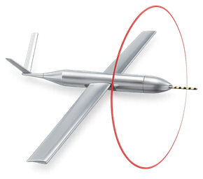
It used to be ceramics, they were bought out by BAE, I'm not sure exactly when, but now we're working with BAE using the Coyote platform, which is a much smaller system, and it doesn't have the range of something like an aerosol, but it gets the job done. So we use our manned platform to get us there, and then we release the Coyote at altitude, and we're looking at maybe an hour, hopefully go up to maybe three or four hours eventually, if battery technology gets us to the point where we can have a pretty long duration mission.
Same sort of goal, still flying at low altitudes, capture a region we can't capture, but just do it a lot more efficiently. We're in the test phase, we've had one, in 2009 we had one flight, clear air, and we're still working to hope to get another clear air test, maybe late this spring, early this summer, and then eventually if things go well, to get something like this in a hurricane, we'll get the Navy, and they have an SBIR to put a MET-type package on, a meteorological instrumentation, so that we can measure the things that we need to measure.
So that's what's been going on, and I can follow up a little bit more if you have any questions on that. Well, yeah, I was kind of wondering, you know, I mean, you've covered some of that, but I mean, are you guys primarily using fixed wing, do you use an NEV toll, or lighter than air, other types of systems, or are you pretty much staying with just one?
We have, as I said, are you all familiar with the Coyote, with what that's all about? I'm not familiar with the Coyote. Well, that is a pretty interesting system. It actually launches out of one of our AXBT, which is an ocean-sensor tube, so it comes out sort of maybe a two-foot-long cigar, if you will, uses that existing chute, and then it pops out, and the wings swing open once it's free, so it's a pretty interesting UAD to look at.
We have another one that we're working with, Embry-Riddle, which uses the same launch tubes, and similar technology, but the aircraft is quite, and that is the Gale, that's being designed out at, it actually has been designed out at Embry-Riddle, and working with a small manufacturing company out there called DynaWorks. So those are the two, that one's a little bit longer term, we're not ready to go as compared to the Coyote, let's say, but they're very similar. Outside of those two, I'll pop over to Alan here, who might want to talk about some other technology.
I don't know if you want to talk about the ocean, but I guess as far as air goes, those are the two platforms we're using here at our lab. Well, I did want to talk about some ocean stuff, but we're going to move into that in the second segment here, and we have to pay the bills here with an advertisement. Okay, so I have one other question, Joe, and it sounds like you kind of already answered it,
and that was, I was curious if you guys were kind of rolling your own stuff, but it does not sound like that, it sounds like you're partnering and working with other folks to develop systems for you, correct?
Yes, that's true. Okay, well, now it's time to pay the bills, so we're going to roll an ad here. Today's podcast is sponsored by Hood Technology. The company offers low swap payloads integrating EO, Mware, and lasers to provide unparalleled long-range imaging from moving platforms.
Visit www.hoodtech.com for more information. H-O-O-D-T-E-Z-H.com. All right, well, we'd like to thank our sponsor, Hood Tech, for sponsoring today's podcast. It's advertisers like that that make this all possible.
Anyway, moving into segment two, Alan, we do want to talk about some of the other systems that NOAA is employing, and the other day we talked a little offline about that, and maybe if you could go into that, we're interested in all-on-man technology, so whatever you're using and the benefits that NOAA's kind of getting from those systems. Sure, absolutely. Happy to talk about that. As you know, we at NOAA rely on data from many different types of platforms, manned or unmanned, to improve our understanding of the Earth's environment, aid in decision-making, our forecasts, and whatnot.
And in recent years, NOAA has really begun exploring the utility of unmanned or remotely piloted systems to address a lot of our needs, including the use of things like high-altitude UAS, such as the Global Hawk, for applications ranging from observing dust plumes from the Gobi Desert traversing the Pacific Ocean, polar weather monitoring in the Arctic, monitoring river flooding stages, and quite frankly also looking at the genesis
and intensification, dissipation of tropical cyclones in the Eastern Pacific, Atlantic, and Caribbean, like Jim talked about, with the lower-altitude stuff, we're also looking at the use of the high-altitude stuff.
We also, of course, use the land and ship-deployed small UAS to do things such as demonstrate the potential to collect high-resolution spatial data on sea ice, glaciers, and the surrounding ecosystem conditions. We look at the use of surface and underwater gliders in the ocean to monitor physical and chemical parameters important for ocean carbon understanding and ocean acidification, for detecting things like harmful algal blooms and other toxins, and looking at water quality conditions in the coastal environment.
We use AUVs to map coral reef habitats and monitor reef and bottom fish populations in the Pacific, to monitor invasive mussel populations in the Great Lakes, to look at things like nautical charting, marine incident and post-hurricane response, and import security surveys. We even utilize tagged marine species to understand the movements and behaviors of large pelagic animals and to measure conditions in areas that might be covered by sea ice, such as in the Arctic. As
you can see, there are many, many different types of practical applications and a great deal of potential for these unmanned systems that Noah is currently looking at.
Having grown up on the coast like I did, it was important for us to know about what was going on. You mentioned the algal blooms, the red tides. We used to go through those. The economy that you guys affect, the fishing economy, the sports fishing, the sportsmen, the recreational stuff, it's vast when you consider the numbers that you guys actually get out there and affect people who enjoy the water, enjoy the coast.
I think that that point needs to be made, that you guys are doing a lot of work that affects people very directly. I appreciate that, Gene. I agree 100%. I don't know the actual numbers.
I don't know that anybody has really, truly ever done the math for how much of the economy Noah truly influences. I think it's no mistake that Noah evolved as part of an agency within the Department of Commerce. Quite frankly, one of the earliest predecessors of Noah was the mapping and charting of the coast put together by Thomas Jefferson. That was largely for trade-based reasons.
I think you can't underscore the important role that Noah plays, not just in protecting people, but also supporting local economies. I was going to make that point about Noah being part of the Department of Commerce, or springing forth from there. But it's very important. A lot of business relies on a weather forecast, and modeling and data and everything else.
In the lives saved and all the rest of that, everyone loves weather. The other thing is, Alan, you went through a lot of stuff that you guys are using, the different types of platforms and everything else. Again, it's kind of an eye-opener. That's the reason we want to have people like you, or you and Joe on the show, is to give people a flavor of what's going on out there.
You see these systems, or you see them in the news on the Internet, or a news story with a couple of hundred words or something. It's really hard to get a flavor of the work that these unmanned systems are doing. To me, it's absolutely fascinating. I know you're using some of the liquid robotics stuff.
The reason that I bring them up is, liquid robotics is... I'm the Silicon Valley chapter president of AUVSI. They are actually members of my chapter. We're actually going to have, if anyone's in the area, our chapter meeting April 17th at the liquid robotics facility.
That ought to be a lot of fun. I really like these kind of field trip deals. You can come out, you can see the shark, which is a wave glider. Maybe, Alan, you can talk about how you guys are using those.
Sure. There's a number of different applications with the wave glider product that liquid robotics has and is continually developing. The area that I've been most looking into is in monitoring things such as ocean carbon pH and ocean acidification-related measurements in the Gulf of Mexico. That's some work that I've been doing with some folks at the University of Southern Mississippi and Mississippi State University.
It builds off of some work that's being done by our sister laboratory in Seattle, the Pacific Marine Environmental Laboratory. We're really trying to look at using these autonomous platforms and the role that ocean carbon plays in ocean acidification. That's obviously a pretty contemporary issue. Also, the other piece that I've been actively working on with liquid robotics is looking at the use of these platforms, these unmanned surface vehicles in tropical cyclones to test the ability of the platform to collect both ocean and atmospheric data at the air-sea interface.
As Joe pointed out, it's a pretty difficult place to collect data. The part that he didn't get into too in-depth is how critical some of that data may be to understanding intensity changes in storms and the growth and decay of those storms. That's one of the areas that we've been looking at with liquid robotics amongst a number of different areas that NOAA is looking at in general with the potential use for their platform or platforms like their platform. Right.
There are other manufacturers out there and whatnot. I've seen their product, their local. I was kind of, even myself, I'd ask them, I said, what's the range on this thing?
They're like, you put it in the water in LA and it'll swim all the way down there to Australia or Japan, which I thought was pretty amazing. That it could do that on its own. Interesting stuff and I'm sure it's helpful to, like you said, measure that kind of where the rubber hits the road between the air and the ocean. A lot of these systems are allowing you guys to, let's say, collect data that you've until this point never had a hard time trying to collect.
Is that a fair statement? Yeah, I think that's a fair statement and I want Joe to be able to chime in here at some point too, but quite frankly, collecting data just above the deck in a tropical storm environment, really the only practical ways to collect it is using autonomous systems in the air or on the ocean or somewhat by serendipity. If the thing happens to drop over a buoy or a moored platform or dropping buoys in advance of a storm from aircraft, which we've also done, had floating buoys in front of the storm collecting data as well.
That's exactly the point is that you want to use these things, I think, in a more proactive way to obtain data that you can't practically or safely get in any other manner. Maybe Joe here wants to chime in and add. Yeah, Joe, jump on in here. The format is like a conversation between friends or whatever and if you don't jump in, you get left out.
Get in here, Joe. What do you got to say?
I mean, I've been just really just kind of absorbing what's been going on around me. I mean, one of the things that I would say, this is getting into the specifics of, let's say we're talking about hurricanes, is that we use these numerical models to predict what they're going to do and that impacts everybody that's in the way of these things, where they're going to go and how strong they're going to be. Over the last 30 years, we've gotten pretty good at giving a good guess at where they're going to go.
We're not perfect, but we're pretty good. The reason why we're doing this so well is because the large-scale environment largely determines where that's going to go. That's called synoptic scale. Just think of it as a big, almost global scale kind of pattern that when you look at satellite imagery, you can see the atmosphere is just a fluid.
You can see how the fluid moves and how this thing can kind of pick up this storm and move it. What we don't have a good measure on is the intensity. We've quite honestly been awful. Over the last 30 years, we've hardly made any advances in that.
A lot of that has to do, there are a lot of reasons, but one of the reasons is that we really don't understand the inner workings of this storm as much as we think we do. If we don't really know what's going on there, what do you think these computer models that are trying to mimic our knowledge can do?
They are just limited. One of the first things we want to do is to capture this environment by really measuring it accurately, improve our understanding, which there's a lot to improve there. Once we have this understanding, to use that data that we're collecting to compare it to the output from the models. When the models give these fields, they're guesses, really.
They're our best guess, but they're a guess. For the first time, we'll be able to compare actual observations with these model guesses. I've already done some of that with some colleagues in the last year, and it's not pretty. In some cases, the models, particularly in the air-sea interface, they're just off.
They're doing their best. It's the best they can do because they didn't have anything to compare it to. If the models aren't getting it correctly, how can we expect them to give us the accurate forecast that we need to help save lives and protect property?
One thing that I think we're working on in the next few years here, and yes, it is years, is to get better pictures of what the storm is doing, particularly in this region of the storm. Then we can move to other regions that aren't covered well. UAS can help us at high altitude, and different types of UAS can help us that way. Once we get that information, then we're going to try to improve these models.
I think UAS and UOVs play a huge role in helping us evaluate and then improve these predictive models that NOAA is responsible for to help basically save lives and property. This is improving our lives and improving, like you said, saving money and property if people have better forecasts and whatever else. I'm really excited about that. It's really interesting how you're using this information and plugging it into your models and how the whole thing is working to make it a better system.
Gene, do you have anything you'd like to add on that? Yeah, in my experience with unmanned aircraft, Joe, and I think what I'm getting from what you're saying is that you've got a sterling record with the P-3 and flying through the storms at altitude, and you're getting some spotty data in between from buoys and fixed platforms and the likes of those sensors. But you've got a gap in between the P-3 at FL, whatever it's flying at, and the sea surface. There's a lot going on between 20 meters and flight level 18, right?
That's where the UA are coming in and that's where they're going to fill in some of that data. Is that a correct statement?
Yeah, that's correct. Let me add a little bit of a visual to this. It goes even beyond that. We have drops on, so we can drop sensors from our altitude and give us a snapshot look.
It's a difference, though, between taking a picture and running a movie. We can get these quick snapshot pictures of what's happening down there, but we don't get the continuity. We don't get the time lapse of what's going on down there. Why that's important, particularly for the atmosphere, is that on convective time scales, on the order of, can be minutes to a half an hour to maybe an hour or so.
On that timeframe, things can change radically. That is the area where the ocean is giving its energy up to the atmosphere. If we don't have a really good handle on not only what it's doing, but how it's changing with time, we really don't have much of a chance. I think that that is one of the reasons why not only we can't get down there because it's not safe, but the little that we do measure down there is very, very spotty.
I think that UAS and U of E's really give us a great chance to tell a better picture and to really capture what's going on in that critical part of the storm. One other thing I wanted to add to that, and I was doing some weather work as part of a project I was on, and I'm not really a meteorologist, but the amount of energy that's in these storms is just astounding. You were going through that, Joe, and talking about the different levels of energy and how things pick up and ebb and flow and all the rest of that.
Can you just speak about that a little bit, the types of energy that's in the storms? Is there any way to put it in brackets, maybe?
Is it like a hurricane? I can talk about how the energy gets out of the ocean or once the energy is in the storm itself. I don't even understand what you would like me to talk about. I can probably talk about both.
How it comes out of the ocean and turns into a storm. One of the things that people don't quite realize, and sadly not just the public, but even some scientists, is that the next time you see someone, a meteorologist talking, they say, well, it's going to go over this warm ocean and it's like a boiling cauldron. Here it comes. It's not that simple.
It's a flux, meaning that it's a vertical gradient. If you've got, let's say, a warm ocean that the storm is going to go over, you need to have a corresponding layer of atmosphere that's conducive to pulling that energy out. Let's say, for example, you have 80 degree water. If your air temperature right above that happens to be 80 degrees, even though that's warm, there's plenty of energy in the ocean, the ocean is shut down for business.
You can't pull that energy out. You have to have a great, it goes from high to low. You have to have a differential, both in moisture and temperature, to pull energy out of the ocean. That's something that's lost most of the time, but it's critical.
That's one of the reasons why we have to go measure down there. What is that near surface gradient?
The larger that differential between the atmosphere and the ocean, the more energy that can come out. It's subtle. We're not talking huge differences. If you have a difference of 10 degrees Celsius, it can make all the difference between not grabbing something out and grabbing it out.
Can I ask real quick, when you're flying your UA's there, the Aerosondra, anything other than the Coyote for that matter, do you guys go up and down in the air column? Do you target one altitude, or do you try to move from, say, 50 meters over the ocean up to 1,000 meters?
Do you go up and down, or is it pretty much a targeted altitude? What we do is, I'm going to take our more recent stuff, where we're looking at these Coyotes and these air deployed UA's. We're really constrained by battery power right now. These lithium ions have given us about an hour of flight time, which is awesome compared to the drop sondes that just stay up literally two to three minutes.
If you do it from a data per minute standpoint, it's extremely valuable data that we're getting because we're staying up. In order to preserve that battery, the sounding, we call it a sounding, which is basically a profile into the atmosphere. We try to do it on the way down, so we come down a little bit slower. If you start to porpoise and go up and down, you just drain that battery so fast it won't happen.
We do that as we have three, four hours on battery life, but right now we're constrained that way. Our sounding comes that way. I would like to stay at certain altitudes. If we can get closest to that, let's say within a couple of hundred meters, certainly, maybe within a couple hundred feet would be optimal.
The problem we also have in a hurricane is that you've got 50 foot waves for the period. You don't quite know. We don't have differential GPS on these things. I want to get a laser altimeter on board so we know exactly where we are right now, but then that's a power draw.
We have all these practical issues that have to come up against the science issues. We would like to stay, if we could, give a nice sounding and then stay at maybe a hundred feet or so if we could. Well, it's funny. I listen to you talking there and you sound just like everyone else that we talk to.
I want to do this, I want to do that, I think we can do this. It's the same thing, but we've got to fight the power drain and all the rest of that. I think we can do this. It's really exciting.
I can hear the passion in your voice too, Joe. We want to do this, it'll be great. This all sounds really good. You're giving us a lot of background and insight.
The 50 foot waves in the hurricane, I haven't really ridden too many hurricanes, but I didn't think about that. I'm sure you guys knew about that and plugged that into your equation. The other thing you were talking about, the energy coming out of the ocean, I guess that's one of the reasons that the modeling is so hard. Oh, absolutely.
Especially, the ocean is something that we have to better understand too, but the ocean's time scale, it's a fluid that's over a thousand times more dense than air. Think of it as a titanic turning, it's a slow moving thing. When you actually mix up that ocean, we have to understand how that happens better. Don't get me wrong, but it happens on the time scales of a storm, 12 hours or so, because the storm moves on, it's gone, out of there.
I think that the ocean, the problem with the ocean and not understanding it fully, we can get there eventually. But the atmosphere is much more problematic, as I said, because it's a less dense fluid, it changes quickly, and if we change by, let's say, a degree Celsius, or to make it even more science geeky here, a couple of grams per kilogram for moisture, because moisture is a real, the gradient moisture is what we want to really capture, because that's how the storm really gets much of its energy, not as much in temperature.
But if we want to capture those two to three grams per kilogram, which is really nothing, it's about 5% relative humidity differences for each gram per kilogram, and if we want to capture, let's say, that level of detail, we really have to get these types of measurements consistently, not once off, not once in a while. Now I've actually stolen the mic so long that maybe Alan needs to jump in and say what
you want. Well, we're actually out of time, which happens every week, I do the same to you, I'm like, oh, 45 minutes, it's going to be hard to cover that, and we always run out of time, but that's how it works.
Do you have a website where folks can keep up with this work you guys are doing? It's fascinating stuff, I love it. You got somewhere where they could come and look?
Well, I think the best place for the stuff that we've got going on here is just our main web page, which is aoml.noaa.gov, aoml.noaa.gov. There are others for a number of the other UAS and UOV applications going on across NOAA as well. I'm happy to share those if you want, but for the stuff that we've been talking about today, primarily the hurricane-related things, aoml.noaa.gov is as good as it goes. All right, well, I want to thank both you gentlemen for coming on, fascinating show.
Thanks again for, you know, these are great. People can listen to these, they can understand how this stuff, like I said, is in the water, in the air, and how it's being used. I want to thank you guys again. I hope to talk to you again in the future, maybe next year we'll have you on, and we can talk about some of the data that you found from this year.
So anyway, again, we had a good time, and Gene, thanks for being on. Absolutely, fantastic show. All right, we'll see everyone next week. Have a good week.
Thank you. Bye.